Sea-Run Fish Regaining Access to the Presumpscot Watershed
Relic Dams Block Fish from Swimming Up Royal River, Stroudwater River, and Some Coastal Streams
WHY IT MATTERS
Being able to move freely among different types of habitats is essential for many aquatic species. Anadromous fish such as river herring, shad, and rainbow smelt, which are prey for commercially important saltwater fish like cod and haddock, must be able to migrate upstream from estuaries to fresh water each spring to reach spawning habitat. Eastern brook trout and other fish that require cold, oxygen-rich water move seasonally among spring-fed streams, mainstem rivers, and estuaries in order to reproduce and feed. Terrestrial animals often travel and feed along rivers and streams.
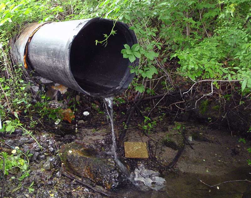
Construction of dams, roads, and railways in Casco Bay’s watershed severed many of these vital linkages and caused severe declines in anadromous fish populations. Dams block passage between upstream and downstream habitats, and interrupt the natural movement of sediment, wood, nutrients, and floodwaters. Where roads and railways cross waterways, inadequate culverts often impede fish passage. Cold-water species cannot thrive in the warm, oxygen-impaired waters behind dams and perched culverts.
STATUS & TRENDS
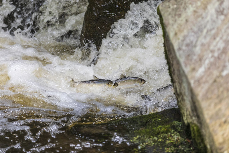
Connectivity between aquatic habitats in Casco Bay and the Presumpscot River watershed has steadily expanded since the 1990s as a result of concerted efforts by NGOs, state and federal agencies, and businesses to remove dams, construct technical fishways, and replace inadequate culverts. These efforts have facilitated restoration of alewife, blueback herring, and shad runs into some historical spawning habitats in the Presumpscot River watershed. These efforts have also benefited sea-run brook trout.Fish Returning to Spawn in Presumpscot River
Current and Historical Amounts of Sea-Run Fish Habitat
| PRESUMPSCOT RIVER | ROYAL RIVER | COASTAL/OTHER | TOTAL | ||||||
|---|---|---|---|---|---|---|---|---|---|
| SPECIES | Units | Current | Historical | Current | Historical | Current | Historical | Current | Historical |
| Alewife | Acres | 640 | 31,597 | 0 | 460 | 85 | 85 | 725 | 32,142 |
| Blueback Herring | Miles | 11.7 | 24.2* | 0.3 | 60.0 | 0 | 0 | 12.0 | 84.2 |
| American Shad | Miles | 11.7 | 24.2* | 0.3 | 60.0 | 0 | 0 | 12.0 | 84.2 |
| Sea-Run Rainbow Smelt | Sites | 2 | 2 | 2 | 2 | 19 | 37 | 23 | 41 |
* Minimum mileage only. May be substantially higher if additional tributaries were shown to be historical habitat. Note that habitat for other sea-run species such as American eel, sea-run brook trout, and sea lamprey exists in Casco Bay streams, but data for those habitats is either not available or not reflected here to focus on the species above. Source: U.S. Fish and Wildlife Service (2015)
Many Fish Spawning Habitats Remain Blocked by Dams and Substandard Culverts
On the map below, orange indicates historical spawning habitats for blueback herring, American shad, and alewife that the fish currently cannot access because of dams and culverts. A survey of the Casco Bay watershed in 2008-2010 found 573 severe (or assumed severe) barriers and 551 potential barriers to fish passage.
successes & challenges
- Maine is a national leader in restoration of stream connectivity. Maine’s Stream Smart training program guides the process of designing and replacing culverts, and the Maine Department of Environmental Protection provides grant funds for addressing derelict municipal culverts. Despite many successes, much work remains, as over 80 percent of culverts pose a barrier to passage of aquatic organisms.
- The pace of dam removal remains slow even though most dams in the Casco Bay watershed are decades, if not centuries, old and no longer serve their original purpose. Despite the compelling ecological and resilience benefits of dam removal, some people are reluctant to embrace the necessary changes in river recreation (e.g., flatwater paddling, fishing, and ice skating) and scenery.
View a PDF version of this page that can be downloaded and printed.
View references, further reading, and a summary of methods and data sources.
STATE OF CASCO BAY
Drivers & Stressors
What’s Affecting the Bay?
Human Connections
What’s Being Done?
If you would like to receive a printed State of Casco Bay report, send an email request to cbep@maine.edu.
This document has been funded by the U.S. Environmental Protection Agency under Cooperative Agreements #CE00A00348-0 and #CE00A00662-0 with the University of Southern Maine.
Suggested citation: Casco Bay Estuary Partnership. State of Casco Bay, 6th Edition (2021).
Photo at top of page: Jerry Monkman, Ecophotography.com

