STATE OF CASCO BAY
Eastern Bay Highlights
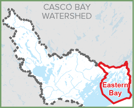
Presented here are key findings for the Eastern Bay.
Indicator J: EELGRASS
Indicator P: ECONOMICS
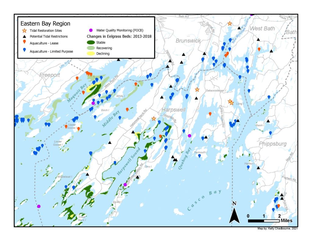
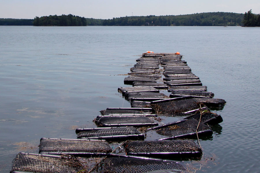
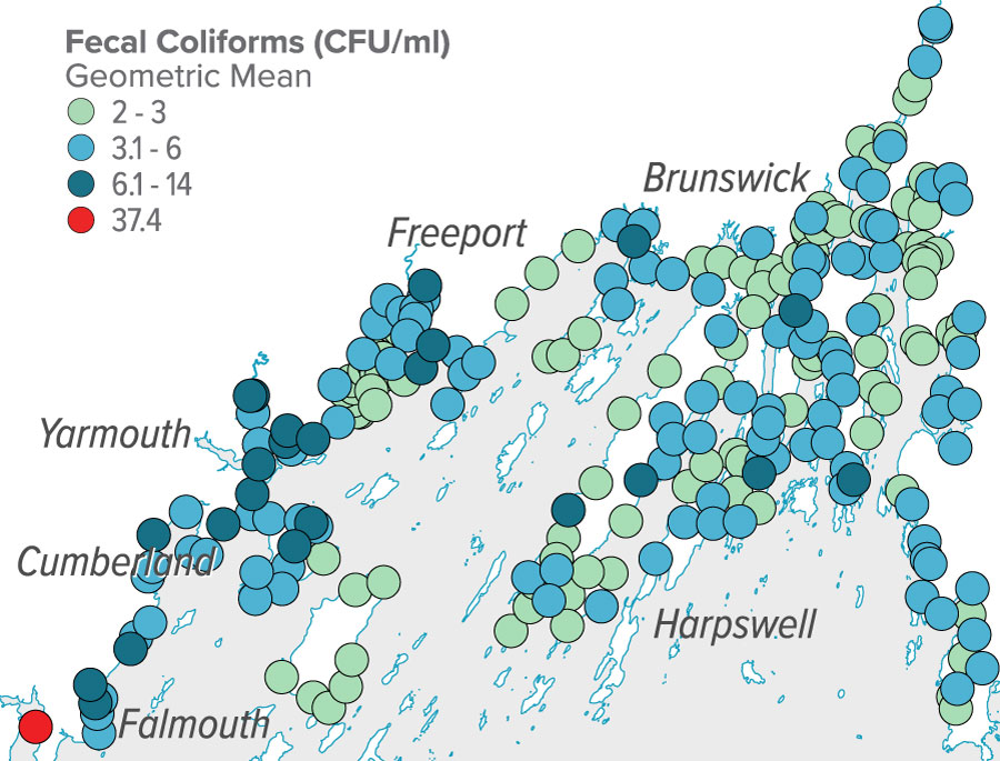
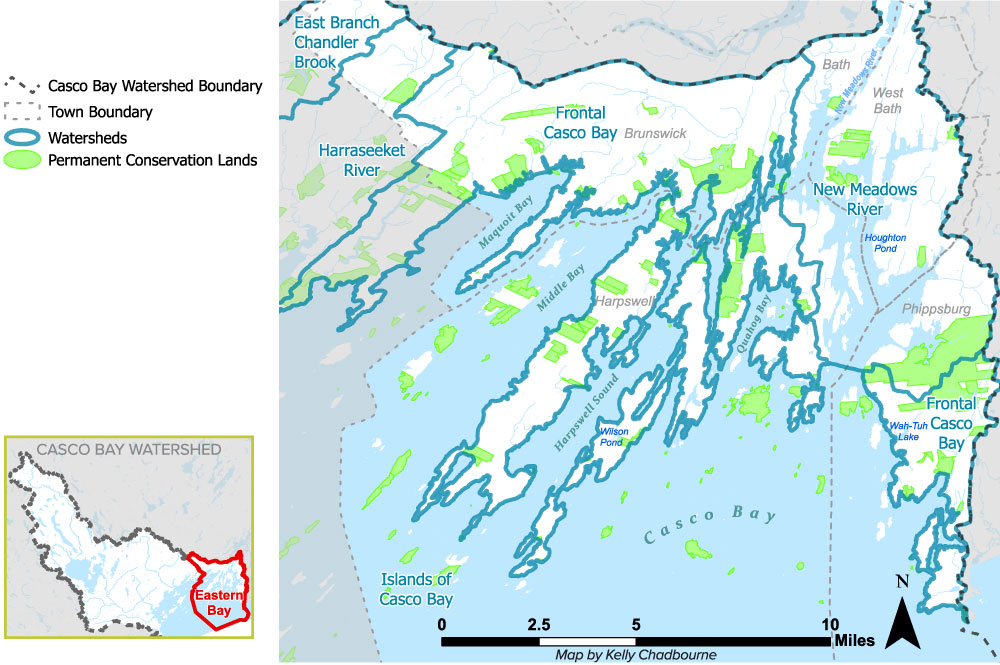
The marine aquaculture industry in Casco Bay is growing rapidly. Long-term leases doubled from 19 to 37 since early 2017, and Limited Purpose Aquaculture leases rose from 137 to 265. See map below. Photo: CBEP
Indicator O: COASTAL HABITATS
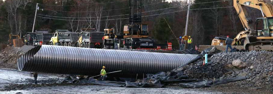
Many tidal marshes have been degraded or converted to freshwater wetlands by roads, railways, dams, and dikes. Replacement of undersized culverts in Brunswick and Harpswell has restored tidal flow to 115 acres of marsh. See map below. Photo: High Head Road Association
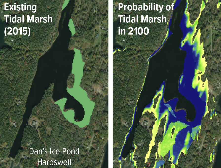
Researchers have looked carefully at the likely impacts of sea level rise on tidal marshes. Models suggest that many of Casco Bay’s larger tidal wetlands will “migrate” into adjacent freshwater wetlands and forests. Elsewhere, rising seas will squeeze tidal marshes against steep slopes or developed areas, leading to losses.
SPOTLIGHT
Tidal Restoration Study
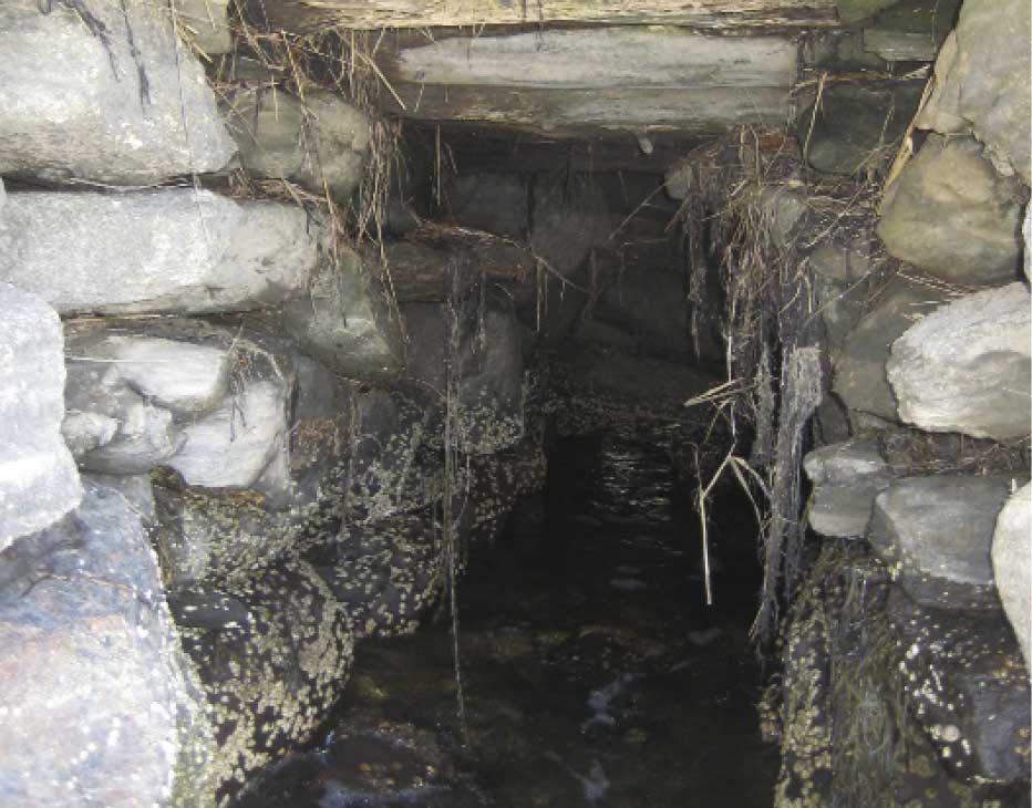
A partnership between the Town of Phippsburg, Maine Coastal Program, CBEP, and others produced conceptual design alternatives for improved tidal exchange beneath Small Point Road. The low-lying road is vulnerable to sea level rise, and the existing timber crib and stone culvert is deteriorating. It severely restricts tidal exchange into the upstream salt marsh, causing changes to the plant and animal communities, and leaving the marsh vulnerable to sea level rise. Photo: CBEP
Community Resilience
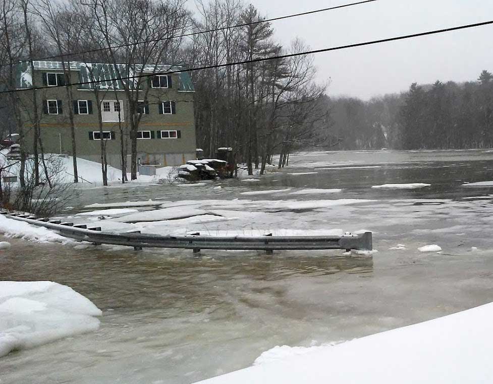
The Town of Harpswell has developed a broad community-wide climate resilience program. In 2014, the Conservation Commission worked with Harpswell Heritage Land Trust and CBEP to identify marshes that might migrate inland and where development could be impacted by sea level rise. In 2015, the Commission mapped areas of the community vulnerable to sea level rise under different scenarios. This was followed by a series of CBEP-supported seminars for private road associations and owners to present the potential impact of sea level rise on their private roads. In 2018, the Town studied the impacts of sea level rise on Basin Point Road. Over time, these activities generated support for the creation of a Climate Resilience Task Force and vulnerability assessment. Photo: Harpswell Conservation Commission
ON THE HORIZON
Balancing Diverse Marine Uses
The long, narrow peninsulas and enclosed bays of eastern Casco Bay define the character of the region. People living, working, and playing must share the region’s bays, tidal flats, and waterways. Patterns of use of coastal waters are shifting for many reasons, including population growth, coastal development, and climate change. Eastern Bay communities are already facing challenges balancing the evolving needs of disparate users, including landowners, waterfront businesses, summer visitors, recreational fishers, aquaculture operators, and commercial harvesters.
Designing for Resilience
Maine Coastal Program and collaborating partners are developing a voluntary set of science-based, field-tested best practices for designing climate-resilient tidal road crossings. CoastWise aims to reverse centuries of impacts to marshes and other tidal habitats by designing safe, low-maintenance crossings scaled to accommodate sea level rise and restore natural tidal flow. Training and outreach on this approach will target coastal communities, private road owners, engineers, and restoration practitioners.
Developing Green Alternatives
In a collaborative project with Maine Coastal Program, Maine Geological Survey, The Nature Conservancy, Maine Coast Heritage Trust, CBEP, Brunswick-Topsham Land Trust, and the Town of Brunswick, three pilot “living shoreline” sites were constructed in Brunswick and Yarmouth. The project is evaluating whether natural materials such as wood, rocks, shell, and plants can be utilized to stabilize eroding coastal banks and provide ecosystem benefits at suitable locations. Project partners are educating landowners and other community members about options for protecting shorelines.
View a PDF version of this page that can be downloaded and printed.
Drivers & Stressors
What’s Affecting the Bay?
Human Connections
What’s Being Done?
If you would like to receive a printed State of Casco Bay report, send an email request to cbep@maine.edu.
This document has been funded by the U.S. Environmental Protection Agency under Cooperative Agreements #CE00A00348-0 and #CE00A00662-0 with the University of Southern Maine.
Suggested citation: Casco Bay Estuary Partnership. State of Casco Bay, 6th Edition (2021).
